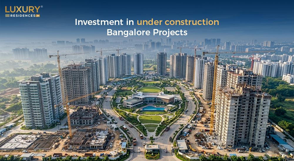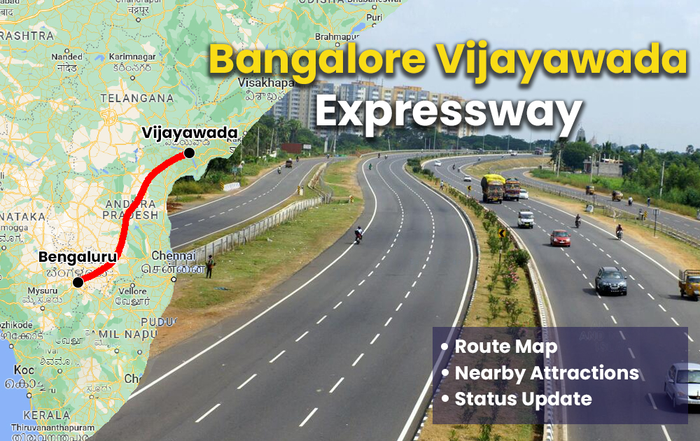
Bangalore Vijayawada Expressway – Info, Route Map, Status Update & More
Bangalore Vijayawada Expressway is the latest project designed by NHAI in collaboration with the government of Andhra Pradesh. This is a 624 km long project developed under the BharatMala Project 3.0. NHAI has approved this project with a budget of 19,200 crores. The main agenda of launching this Bangalore Vijayawada Expressway is to cut short the total commutation time between both cities. In this article, we will learn more about the Bangalore Vijayawada Expressway, route map, investment, and future routes.
Bangalore Vijayawada Expressway Highlights
Bangalore Vijayawada Expressway is a joint venture between NHAI and Andhra Pradesh government. Here are the major highlights associated with the project:
| Bangalore Vijayawada Expressway | |
| Owner | National Highway Authority of India (NHAI) |
| Route Map | Bangalore to Vijayawada |
| Total Investment | Rs 19,320 cr |
| Project’s Approx. Length | 624 KM |
| Total Lanes | 4 Lanes 6 lanes |
| Right of Way | 100 m |
| Design Speed | 124 kmph |
| Total Sections | Brownfield Upgrade – 73 KM Greenfield Section – 343 KM Brownfield Upgrade – 113 KM |
Bangalore Vijayawada Expressway Key Highlights
- The Bangalore Vijayawada expressway will reduce the commutation time between both cities by 6 hours
- The expressway is been constructed under Hybrid Annuity Model (HAM). As per this model, 40% of the total cost will be furnished by the NHAI and the rest 60% will be sanctioned by the state government
- Bangalore Vijayawada expressway will be developed under the Bharatmala Pariyojana and is going to be a six-lane project. 65% of the project will be developed as a greenfield area and the rest 35% will be a brownfield area
- The corridor is been developed to cater to a speed of upto 124 kmph
- The project will pass by the town of Kadapa and is also known as BKV Expressway.
- The expressway will connect towns and villages namely, Kodikonda, Pulivendula, Mallepali, Vangapadu, Addanki, Chilakaluripet and Guntur and Vijayawada
Bangalore Vijayawada Expressway Route Map
This Bangalore Vijayawada expressway has been rolled out to connect major villages and towns between the two cities. Here you can check out the route map between both the cities.
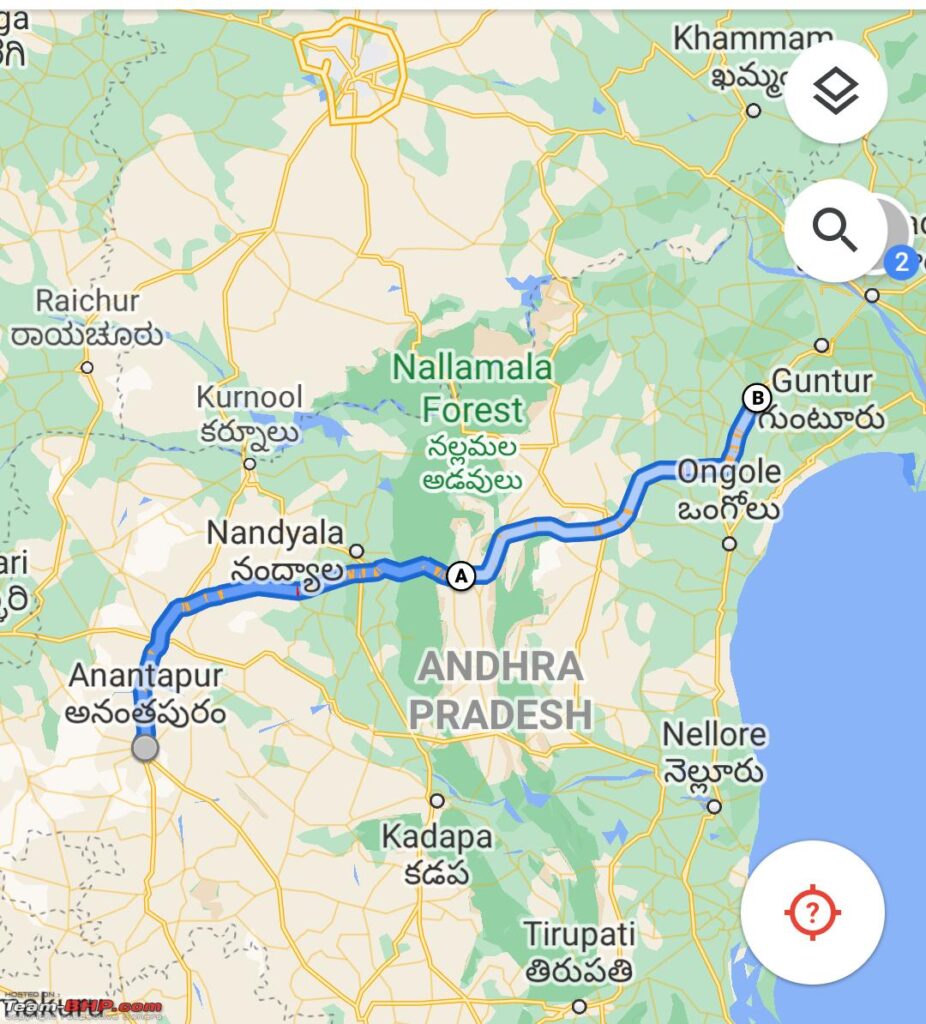
Bangalore Vijayawada Expressway Sections
Presently, the total time to cover the route between Bangalore and Vijayawada is 12 hours. However, with the new expressway, the total time will be reduced by 50%. Now, it will take only six hours to cover the entire route. This is mainly because of three sections between Bangalore Vijayawada expressway. The following are three sections that will be covered between 650 KM.
| Section Name | Route | Total Distance |
| Brownfield Upgrade | NH-44 Bengaluru, KA to Kodikonda, AP | 73 KM |
| Greenfield Section | Kodikonda, AP to Addanki, AP | 343 KM |
| Brownfield Upgrade | NH-16 Addanki, AP to Vijayawada, AP | 113 KM |
Bangalore Vijayawada Expressway Nearby Infrastructure
The Bangalore Vijayawada Expressway will be developed under the Bharatmala Pariyojana Phase-II in 2023 by the Indian government. The project is been developed in collaboration with the NHAI and Andhra Pradesh government. This was announced by Union Minister of Road, Transport and Highways, Nitin Gadkari as one of the major projects of the state. The Bangalore Vijayawada Expressway is been developed as a 650 KM route.
Out of the total distance, the 360 KM is going to be constructed as a four-lane highway. This will be helpful in saving a lot of time to commute between the two cities. As mentioned earlier, the total time will be reduced by 50% to only 6 hours. Whereas, the remaining 110 KMs will be developed to enhance the connectivity with the Bangalore-Vijayawada Expressway with the existing national highways.
Bangalore Vijayawada Expressway Total Cost
The Bangalore Vijayawada Expressway has been developed by NHAI and Andhra Pradesh government. The project has been allotted a total investment equal to Rs 19,200 crores. NHAI has constructed the route map considering the major villages and towns between both cities. As of now, the state government has approved the proposed Bangalore Vijayawada Expressway route map between the two cities.
Bangalore Vijayawada Expressway Further Connectivity
Bangalore Vijayawada Expressway has been proposed to connect both the major cities of Andhra Pradesh and Karnataka. However, the government is planning to extend it to other national highways as well. This will foster easy movement and commutation to other parts of the city. This expressway will be connected to the Chennai-Kolkata NH-65. The main idea behind this offering easy connectivity of the coastal districts from Srikakulam to Nellore with Bengaluru.
Bangalore Vijayawada Expressway FAQs
1. What is the NHAI project from Bangalore to Vijayawada?
Ans. Bangalore Vijayawada Expressway is the latest NHAI project from Bangalore to Vijayawada.
2. What is the new expressway in AP?
Ans. Bangalore Vijayawada Expressway is the new expressway in Andhra Pradesh.
3. How much time does it takes to travel from Vijayawada to Bangalore?
Ans. Presently, it takes 12 hours to travel from Vijayawada to Bangalore.
Stay updated with the latest Developments in Real Estate across top cities – Mumbai, Gurgaon, Pune, Bangalore, Thane, Hyderabad, Delhi, Himachal Pradesh, Goa, Noida, Panchkula, and Dubai to make informed investment or home-buying decisions.